Long before BART and AC Transit, the Key System’s orange-and-cream trains tied the East Bay together, and the “A” line ran all the way to our doorstep on Havenscourt Boulevard.
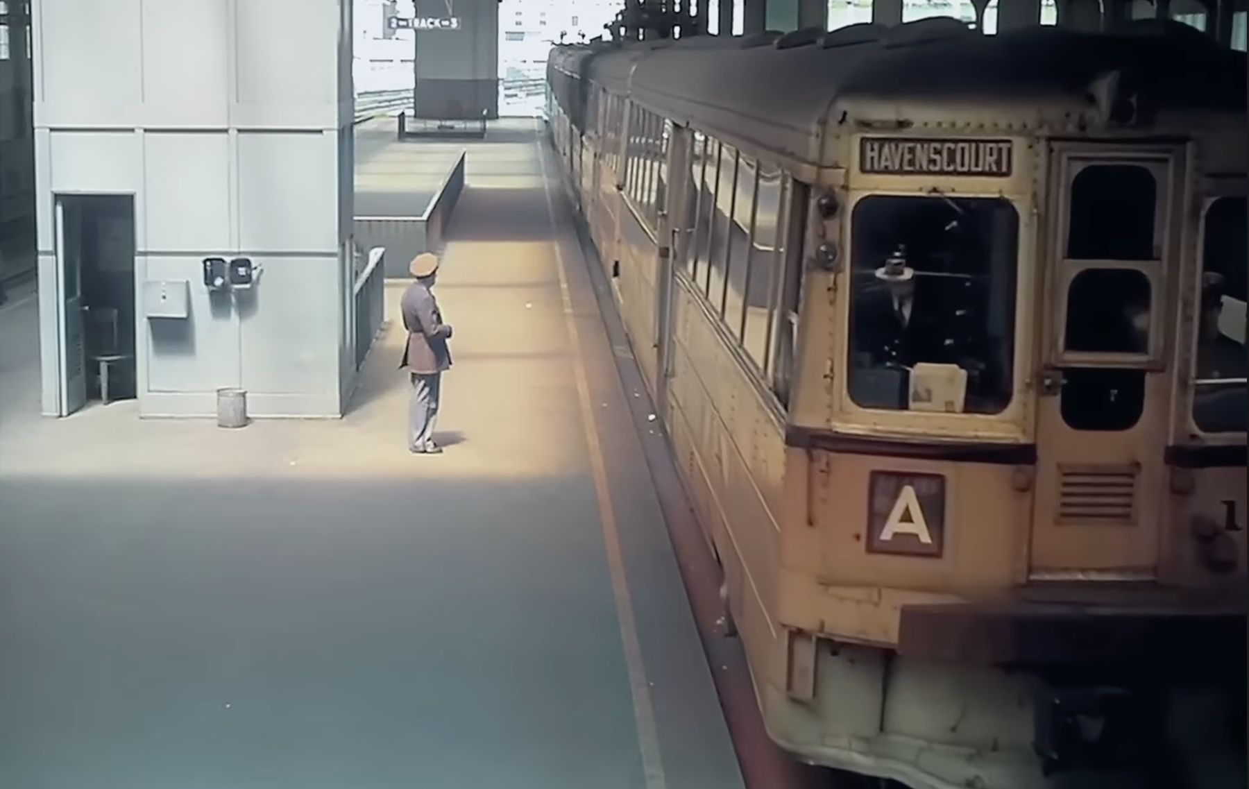
Film still courtesy of the Prelinger Archives. Colorization by NASS.
The line that built our neighborhood
The Key System ran streetcars, trains, and buses across Oakland, Berkeley, Alameda, and beyond for the first half of the 20th century. Its lettered “transbay” routes eventually ran across the Bay Bridge into San Francisco. The A line terminated on Havenscourt Boulevard, and easy service downtown is a big part of why the homes and blocks of East Oakland grew up where they did.
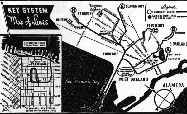
Rail service across the bridge ended in the late 1950s, and the system was replaced by AC Transit buses in 1960. You can still trace parts of the old routes in the shape of our streets today.
America’s first coast-to-coast highway, right up the hill
Trains weren’t the only way through. The Lincoln Highway, launched in 1913 as the first road for cars to cross the entire United States, wound through Oakland on its way between New York and San Francisco. Its route through East Oakland followed Foothill Boulevard, along the uphill edge of our neighborhood just above Bancroft. Early motorists heading for the Bay rolled right past our blocks.
The Detroit of the West
Right on that highway sat the Chevrolet assembly plant, for decades a major source of jobs in East Oakland. It opened in 1916 as the first automobile factory on the West Coast, and by the time it closed, it was turning out around 55 cars an hour. Factory jobs like these helped draw working families out to this part of town.
In 1963, General Motors moved production to a new plant in Fremont. Eastmont Mall opened on the old factory site in 1966, on the land bounded by Foothill Boulevard, Bancroft Avenue, 73rd Avenue and Church Street. Today it’s the Eastmont Town Center, home to the Oakland Police Department’s Eastmont substation, where our NCPC used to meet in person.
A crossroads, then and now
Put it together, and our corner of Oakland was where the East Bay’s streetcar line, the nation’s first transcontinental highway, and a major auto factory all came together. The train, the road, and the plant all helped shape the neighborhood we live in today.
Learn more on Wikipedia’s Key System and Lincoln Highway articles, or Oakland Wiki’s page on the Chevrolet Assembly Plant. Have old photos or stories of the neighborhood? We’d love to see them.